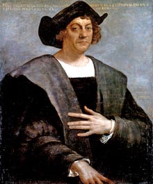
“ By prevailing over all obstacles and distractions, one may unfailingly arrive at his chosen goal or destination.” - Christopher Columbus
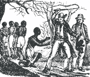
In 1400 A.D Europeans made a great effort to discover the things they had never seen before throughout the globe. From ancient stories came images of bizarre looking people and illustrating the lands of the unknown East. Europeans had several misconceptions of the unknown world. They lacked the concept of Africa and Asia land sizes, and based several of their understandings of the unknown world on the Bible. Following the bible they believed that the earth was seven-eighths land and that Africa was connected to a greater southern continent. The Americas, Australia, and Antarctica were not known to existence by the Europeans. The European exploring countries were Portugal, Spain, France and England. Although there were several misconceptions scattered throughout the time, these key ideas helped to inspire and lead explorers such as Columbus, Magellan and John Cabot to the Far East (Newman). Even though the explorations had several successes and failures- such as the slave trade- a lot was discovered and learned throughout the years.
Ship design/Technology:
Among the many leading key factors, technology was a large factor around the 1300’s. The development of sbigger sea ships helped pave the way for more stronger ships. Eventually narrow ships, triangle ships, caravels, compasses and astrolabes were invented, supporting the ideas of voyages and discoveries (Newman). By the 18th century, exploration in the Maritimes had become much more safer and efficient with advances such as theodolite, octant, precision clocks, compasses and telescopes. “Europe’s ability to adapt and extend the information and technology receives from outside sources and to combine this with its own expertise and aggressive zeal gave it a decisive advantage even over the relatively sophisticated commerce and technological resources of maritime Asia.” (Arnold). From the book the Age of Discovery by David Arnold, this quote really shows how the Europeans were able to advance with their modern technology as they witnessed other forms of advancements, these remarks and experiences helped the Europeans become more technologically advanced on their voyages to the unknown world.
Map and navigation refinements/Geography:
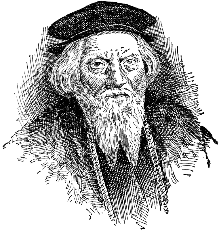
Most of the travelling done in the Age of Exploration was in the efforts to find new trade routes, but the advancement in geography was also a very significant event during the time. When exploring areas like the Americas and Africa, the European explorers were able to bring back more knowledge of the outer world back home to Europe. Explorers would bring new species and cultures to analyse. Prince Henry the Navigator from Portugal conducted the first of many journeys associated with the Age of Discovery. He and his sailors discovered the Madeira Islands in 1419 and the Azores in 1427. The main goal of the Portuguese during these voyages was to discover a trade route system to west Africa, this would mean they wouldn't have to do trading through the Sahara Desert. This was accomplished in the mid-1400s when a trading port was established in Elmina of West Africa. Navigation systems also advanced and improved as a result of people like Prince Henry the Navigator, who always imagined the world bigger than on the maps he read (Gallagher). Before his navigations into the unknown world, navigators would traditionally use portolan charts-navigational maps that would be based on compass directions and estimated distances by seas pilots- which kept them close to the shoreline. He created one of the first nautical maps on his many expeditions. His development would be later remade and refined by other explorers like Columbus, Cabral, and Vasco De Gama.
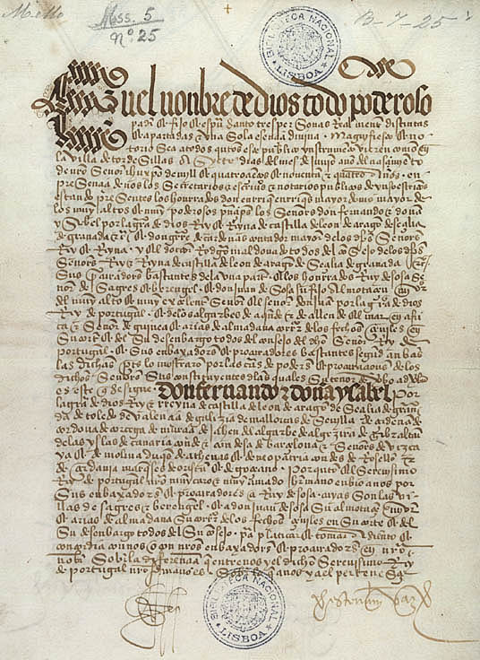
Christopher Columbus was also attempting to find a trade route from Asia by sailing West at the time. When he reached America in 1492 he shared his newly found information to Spain and the rest of Europe. This new information caused a conflict between Spain and Portugal in terms of newly claimed lands when the Portuguese explorer Pedro Alvares Cabral set off to exploring Brazil. As a result of the growing conflict, the Treaty of Tordesillas was established in 1494, dividing the world in half (Pletcher).
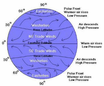
Discovery of the Trade Wind system:
Before the more recent steamboat invention in 1807, the world’s ships depended largely on the winds as their ships fuel for power. The winds movements were either fairly predictable or prevailing which falls into two main belts, the trade winds and the westerlies.
The Trade winds begin near the equator at 0” latitude. The earth’s surface area pressure becomes low as the air warms up and rises towards the atmosphere. Around the north and south of the equator the air becomes heavy and rushes towards the low pressure areas. The cooler air is then heated and the whole system starts over again. The Trade winds belt is essentially the same but due to the force of the earth’s rotation winds act differently because of the change in latitude. The map below shows the two different trade wind systems. Early Portuguese and other European explorers used these systems as techniques to move the larger boats as they realized that the surface water was being “dragged” in the same direction as the blowing winds. They used this to their advantage by the late 1400s (Newman).
In 1400 A.D Europeans made a great effort to discover the things they had never seen before throughout the globe. From ancient stories came images of bizarre looking people and illustrating the lands of the unknown East. Europeans had several misconceptions of the unknown world. They lacked the concept of Africa and Asia land sizes, and based several of their understandings of the unknown world on the Bible. Following the bible they believed that the earth was seven-eighths land and that Africa was connected to a greater southern continent. The Americas, Australia, and Antarctica were not known to existence by the Europeans. The European exploring countries were Portugal, Spain, France and England. Although there were several misconceptions scattered throughout the time, these key ideas helped to inspire and lead explorers such as Columbus, Magellan and John Cabot to the Far East (Newman). Even though the explorations had several successes and failures- such as the slave trade- a lot was discovered and learned throughout the years.
Ship design/Technology:
Among the many leading key factors, technology was a large factor around the 1300’s. The development of sbigger sea ships helped pave the way for more stronger ships. Eventually narrow ships, triangle ships, caravels, compasses and astrolabes were invented, supporting the ideas of voyages and discoveries (Newman). By the 18th century, exploration in the Maritimes had become much more safer and efficient with advances such as theodolite, octant, precision clocks, compasses and telescopes. “Europe’s ability to adapt and extend the information and technology receives from outside sources and to combine this with its own expertise and aggressive zeal gave it a decisive advantage even over the relatively sophisticated commerce and technological resources of maritime Asia.” (Arnold). From the book the Age of Discovery by David Arnold, this quote really shows how the Europeans were able to advance with their modern technology as they witnessed other forms of advancements, these remarks and experiences helped the Europeans become more technologically advanced on their voyages to the unknown world.
Map and navigation refinements/Geography:
Most of the travelling done in the Age of Exploration was in the efforts to find new trade routes, but the advancement in geography was also a very significant event during the time. When exploring areas like the Americas and Africa, the European explorers were able to bring back more knowledge of the outer world back home to Europe. Explorers would bring new species and cultures to analyse. Prince Henry the Navigator from Portugal conducted the first of many journeys associated with the Age of Discovery. He and his sailors discovered the Madeira Islands in 1419 and the Azores in 1427. The main goal of the Portuguese during these voyages was to discover a trade route system to west Africa, this would mean they wouldn't have to do trading through the Sahara Desert. This was accomplished in the mid-1400s when a trading port was established in Elmina of West Africa. Navigation systems also advanced and improved as a result of people like Prince Henry the Navigator, who always imagined the world bigger than on the maps he read (Gallagher). Before his navigations into the unknown world, navigators would traditionally use portolan charts-navigational maps that would be based on compass directions and estimated distances by seas pilots- which kept them close to the shoreline. He created one of the first nautical maps on his many expeditions. His development would be later remade and refined by other explorers like Columbus, Cabral, and Vasco De Gama.
Christopher Columbus was also attempting to find a trade route from Asia by sailing West at the time. When he reached America in 1492 he shared his newly found information to Spain and the rest of Europe. This new information caused a conflict between Spain and Portugal in terms of newly claimed lands when the Portuguese explorer Pedro Alvares Cabral set off to exploring Brazil. As a result of the growing conflict, the Treaty of Tordesillas was established in 1494, dividing the world in half (Pletcher).
Discovery of the Trade Wind system:
Before the more recent steamboat invention in 1807, the world’s ships depended largely on the winds as their ships fuel for power. The winds movements were either fairly predictable or prevailing which falls into two main belts, the trade winds and the westerlies.
The Trade winds begin near the equator at 0” latitude. The earth’s surface area pressure becomes low as the air warms up and rises towards the atmosphere. Around the north and south of the equator the air becomes heavy and rushes towards the low pressure areas. The cooler air is then heated and the whole system starts over again. The Trade winds belt is essentially the same but due to the force of the earth’s rotation winds act differently because of the change in latitude. The map below shows the two different trade wind systems. Early Portuguese and other European explorers used these systems as techniques to move the larger boats as they realized that the surface water was being “dragged” in the same direction as the blowing winds. They used this to their advantage by the late 1400s (Newman).

Timeline: (click for more information)
|_______________________|________________________|___________________________________________________________________|
1492 1494 1497 1619